Ayutthaya one of the major tourist attraction and was founded in 1350 by King U-Thong. It was the capital of Thailand (then called Siam) for 417 years from 1350 until it was sacked by the Burmese army in 1767. During this era Ayutthaya had 33 kings of different dynasties ruling the kingdom This period of Thai (Siamese)history is now usually referred as the Ayutthaya period or Ayutthaya kingdom. The Bowring Treaty (1855), signed by King Mogkhut between Siam and Britain, was the first of its kind and successfully opened up Siam to Western influence and trade.
The ruins of the old capital in the Ayutthaya historical park are now a UNESCO World Heritage Site and have been so since December 1991. The province is also home to the Bang Pa-in summer palace complex.
Originally named Krung Kao , the province was renamed to Phra Nakhon Si Ayutthaya in 1919.
Old painting of Iudea (Phra Nakhon Si Ayutthaya in nowadays).

Yai Chai Mongkol temple


Napramain Temple

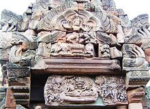
Narayana on the garuda.

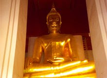
Pra Phuttha Nimit Wichit Mann Molee Srisanpech Borom Trilokanad.

Pra Khan Than Rasd.

Luang Pho Kao.

Old pagoda.

Church of Luang Pho Mongkol Bopit.

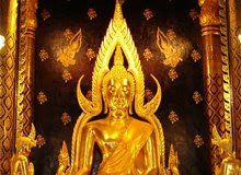
Luang Pho Mongkol Bopit.

Pra Srisanpech Temple.


Phanan Choeng Temple.


Mahathat Temple.



.jpg)
.jpg)
